fbpx

ALERT California: “Seeing” Fires from a Distance. What you can do to protect your property from wildfires. (2022)

Wildfires are a significant threat to many communities in California. The ALERT California program is an innovative partnership between local Internet Service Providers and counties that aims to provide open-source tools for the public's use during emergencies such as wildfires.
One of these tools is high-powered, panoramic cameras strategically placed on public and private towers to catch fires before they start or spread too far. These cameras also can see other things such as lightning strikes and weather conditions, providing live streams so you can check them out anytime if you’re concerned about your safety or want to know what’s going on with wildfires near where you live.

Conifer Communications plays a vital role with the ALERT California program by providing sites and internet services to the California Central Sierras.

What is ALERT California?

UO logo
UCSD logo white
unr logo

The ALERT California consortium comprises three universities: the University of Nevada, the University of California at San Diego, and the University of Oregon. Its goal is to provide public access to cameras that can tilt, pan out and zoom in. The video camera views of this partnership are intended to help fire agencies find fires, monitor the behavior of fires, and assign emergency resources. The ALERT California Program has steadily expanded across the western United States.

Who is Behind the ALERT California program?

Led by Dr. Graham Kent of the University of Nevada, Reno, there is a dedicated team of men and women who work on the ALERT California program behind the scenes at universities across the west: Dr. Ken Smith of the University of Nevada Reno, Dr. Neal Driscoll, of the University of California-San Diego and Dr. Doug Toomey of the University of Oregon. </span

Dr. Kent has spent the last five years working with county, state, and federal officials and legislators, along with small local internet providers, to work through all of the logistics necessary for this program to be a success.
This initiative, which uses thermal cameras to detect wildfires from an early stage, has been funded by settlements from electric utility companies, federal and state grants, donations of equipment, and funds by businesses such as Conifer Communications.
This team partners with regional Internet providers to gain access to the critical mountains and hilltops in an area for the best views. Internet service providers are the ideal partner as they have the locations and connect speeds needed to support this advanced technology.

This initiative, which uses thermal cameras to detect wildfires from an early stage, has been funded by settlements from electric utility companies, federal and state grants, donations of equipment, and funds by businesses such as Conifer Communications.

More about the ALERT California Program

With over 700 cameras in service across California, Nevada, Oregon, Washington, Idaho, and Utah, the network provides fire cameras and tools to help firefighters and first responders to:

  1. Discover, locate, and confirm fire ignition.
  2. Quickly scale fire resources up or down.
  3. Monitor fire behavior during containment.
  4. Help evacuations through enhanced situational awareness.
  5. Observe contained fires for flare-ups.

[use the video on the beta site: http://alertca.live.]

These cameras are critical for mountain top asset protection. It gives CalFIRE, BLM, and USFS those needed eyes to protect assets. 

Each camera has the ability to tilt, pan out and zoom in. They also use near-infrared “sight” to allow for the detection of fires at night. When a spark is found, the team triangulates its position using one or multiple cameras and mapping out its relative distance from the fire site. This allows first responders to know where the fire is and the best way to attack it without having to guess which road will be the best access route. 

How Conifer Partners with ALERT California
conhead

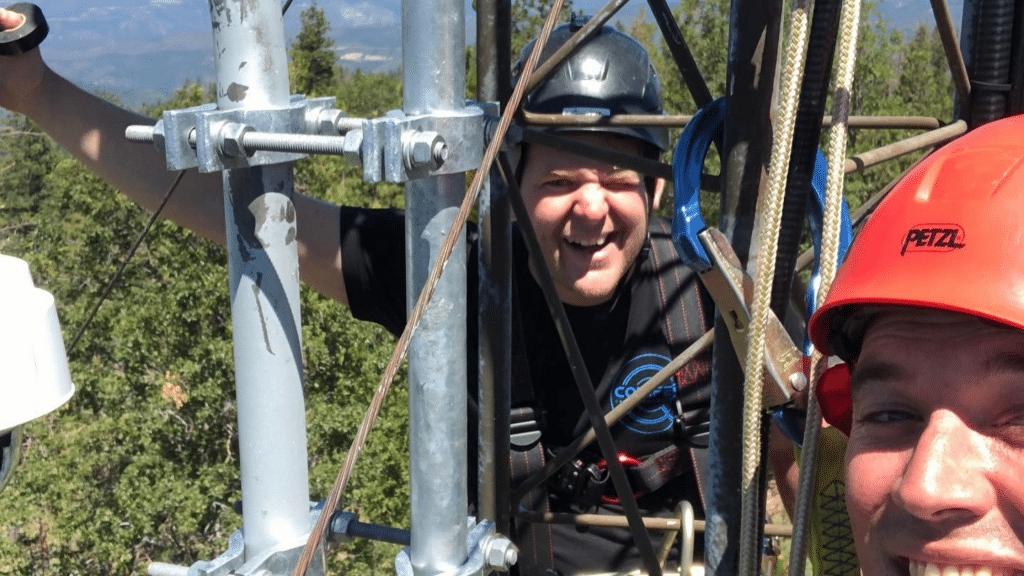
Conifer Communications is a critical partner with the ALERT California program by providing sites and internet connections in the California Central Sierras. We support about 30 cameras within Amador, Calaveras, Tuolumne, and Mariposa Counties. We do this by installing the cameras on our internet service towers. We monitor the power they receive and the quality of their internet connection and make sure to keep up and live even through Public Power Safety Shutoff events. While we do not have control over where the cameras are pointed (that is the job of the operations team of ALERT California, CalOES, and CalFire), we do ensure that the cameras are blocked from viewing or recording any private property near the cameras to keep all our neighbors and customers safe.

The ALERT California cameras in our local community have been critical in pinpointing the location of fires and helping first responders stop the fires. As the cameras are available to the public, they allow local residence more information about fires in their area. This has given many people an early warning when needing to prepare for evacuation. It has also provided some peace of mind when they are out of the area, but they can see that the fire is not on their property. 

How ALERT California Helps Communities
Copy of wildfirepartner

Sometimes the way to understand how beneficial a program can be is to hear it directly from those it has helped. These testimonials and video footage show how ALERT California has helped to prevent the growth of 1000s of wildfires:

"I am a Fire Captain in the CAL FIRE-San Diego Unit Emergency Command Center (ECC). We are an "Interagency Center," meaning we work directly alongside the Cleveland National Forest (CNF) dispatchers. Our center functions as a "blended" center, also meaning we will dispatch CAL FIRE resources and CNF simultaneously to an incident and vise versa. I cannot express enough how beneficial the use of the PTZ ALERTWildfire Cameras on the Alert SDG&E Camera system are for the fire service. Since we were granted access in 2017, we have utilized the cameras to detect and/or confirm fires in San Diego County area. The use of the PTZ cameras has been heavily utilized in the last year. Before we had access to the PTZ cameras, we would often go to the UCSD/HPWREN cameras for weather and fire/smoke checks in an area. The UCSD cameras take a still photo every 1-2 minutes, and then the user is responsible to "refresh" the browser to get an updated picture. Now, with access to the PTZ cameras, we are receiving a near-perfect live stream from the camera. Let me explain a little how we use the system: First, we receive an alarm for a wildland fire, smoke check, or another type of fire in an area from either 911 callers, field personnel, or any of our cooperating partners in San Diego County. Based on the location and type of report from the reporting party, a Fire Captain will then go to the PTZ Cameras and click on the link to the most appropriate camera that will have a visual of the reported problem and area. Based on what is visual can dictate our response. If we see smoke, then we know we have a fire; and we will start our appropriate response, which will include multiple ground resources and possibly multiple air resources (Air Attack, Air Tankers, and helicopters). If we do not see smoke, then we can send a response appropriate for a "smoke check" (1-2 engines typically). Last year, we had the "Lilac Fire" in December, which burned approximately 5,000 acres and multiple structures damaged or destroyed, and severe loss of horses at a thoroughbred training center. When we first received a report of the fire, we immediately went to the most appropriate camera and confirmed we had a fire. Based on the live stream of the camera, we were able to augment (increase our initial resources) on the initial dispatch due to the smoke conditions and the proximity to a mobile home park before we had the first unit at the scene. I feel that the use of the cameras aids us in being proactive and not reactive in our response. We would rather be ahead of the curve than playing catch-up. The other use of the PTZ cameras is for weather observations. Our center does weather observations three times a day. Based on the visual of our weather, we input a set data marker into a database that takes our observations and the local RAWS station information and converts it to numerical value for the Burning Index. We base our level of vegetation fire response (Low, Medium, High) on the numerical value of the burning index. As the network improves and more cameras are added to the system, I can see how this system will drastically improve our response to vegetation fires in the future and could possibly assist in the way we dispatch responses to a fire."
cropped android chrome 192x192 1
Cory K. Costa
Fire Captain CAL FIRE – San Diego Unit
MONTE VISTA INTERAGENCY COMMAND CENTER Lilac Fire (SD County)  Cameras were on the Lilac 35 seconds after the 9-1-1 call; it allowed fire management officers to gamble and throw all resources at the fire as he could see both the severity of the fire and no other fires at that moment in San Diego county. They halted at 4000 acres on the worst fire conditions ever recorded in SD County. Other SoCal fires burned much more acreage. 
"As a Fire Chief in the Tahoe Basin, I cannot express the importance of the University of Nevada, Reno (UNR) Fire Cameras that are installed around the Basin and both states, Nevada California. Not only do these cameras help dispatch centers with confirmation of fires but also what resources (air and ground) will be needed to manage and mitigate the incident. With the aforementioned, responders also use the cameras. We utilize the cameras daily to gather fire activity intelligence pertaining to activity before and during a fire or incident. These cameras not only help with fires but also avalanche activity on the slopes above communities during the winter months. Additionally, as a member of the Sierra Front Incident Management Team, it is important to see location, topography, and visual weather conditions. These cameras are worth every dollar with respect to firefighters, first responders, and citizen safety and natural resources. Time is of the essence in these scenarios, and these networks of cameras have the potential to save lives, property, and taxpayers' dollars."
cropped android chrome 192x192 1
Ryan E. Sommers
Fire Chief North Lake Tahoe Fire Protection District

Stopped Arson near Emerald Fire near Lake Tahoe
1:45 minutes later, an arsonist uses Emerald Fire to try and sneak a fire into a neighborhood at South Tahoe in 60 MPH winds. Early discovery/situational awareness, fire is knocked down.

How you can Participate in the ALERT California Program
camera

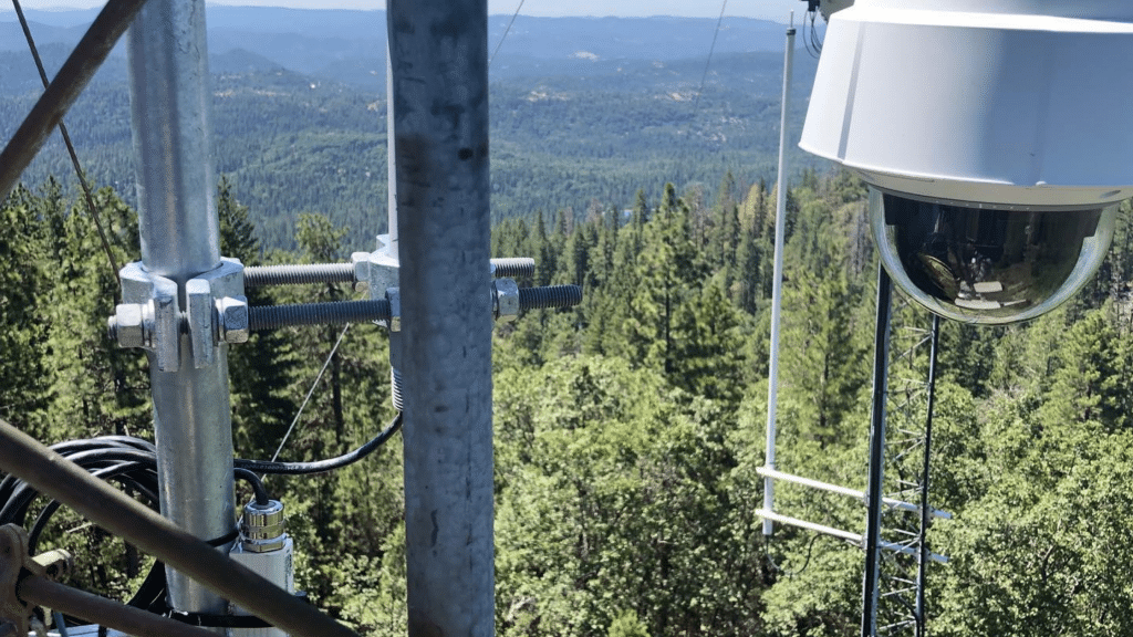
The ALERT California program is an innovative partnership between local Internet Service Providers and counties to allow for equipment and cameras to be mounted on public towers. These are strategically placed high-powered, panoramic cameras that can see fires from a distance as well as any other activity in the area, including weather conditions such as lightning strikes. The site provides live streams of these views, so you can check them out anytime if you’re concerned about your safety or want to know what’s going on with wildfires near where you live. You can also report fires yourself by clicking through the links at http://alertca.live/

This information could save lives, property, and taxpayer dollars when it comes down to it! We hope our community will continue to support public-private partnerships and volunteer efforts in the future. Please consider supporting these efforts by contacting your supervisor if you want a camera installed on a tower near your home or business.
Conifer Communications

Conifer Communications

Rural High Speed Internet Provider with Unlimited Data

About Conifer Internet

High Speed Wireless Internet
Unlimited Data – No Hidden Fees
Tuolumne, Calaveras, Mariposa, Merced, & Stanislaus Counties

Recent Posts

Follow Us

Conifer Technology: Fixed Wireless vs Satellite